


Click here for the previous segment of this trip aboard VIA Rail Canada!
Day One - Thursday, April 17, 2003 - Rocky Mountaineer - Eastbound
The alarm has gone off. It seems that I had just gotten into bed. It is 05:00h and we have to be active as the Rocky Mountaineer is scheduled to leave on its maiden voyage for the 17th Season at 07:00h. Doug Symons and I are off on a spectacular spring tour of the Canadian Rockies by rail.
A few days previous, we arrived in Vancouver by VIA Rail and immediately got a ferry from English Bay to head to Nanaimo on Vancouver Island. From there we went and stayed with Doug's brother, Jim and his lovely wife, Beth. We were given a quick tour of the northern part of Vancouver Island as we travelled to Comox. We had a great home cooked meal and an early evening. The next morning we were up at 07:30 to get out to the Comox airfield to see the Canadian acrobatic air team, the Snowbirds, in a rehearsal of their 2003 show. We were soon on our way south as we were to meet a friend, Peter Darroch, in Ladysmith, which is about half way between Comox in the north and the capital city of Victoria. Peter provided commentary along the route finishing with a quick but thorough tour of Victoria's downtown. We went to Peter's house to meet his delightful wife, Sharon and son, Shane for dinner. A few new friends, Randy and Lyle joined us for delicious fresh halibut dinner. Unfortunately, we were soon on our way to catch the 19:00h ferry for the trip back to Vancouver Island.
The approximately two-hour crossing was very smooth and we arrived and quickly boarded the bus for the trip to the city.
Arriving at the Sheraton Wall Hotel in Vancouver, we were greeted by enthusiastic and friendly front desk personnel. The room was spacious with two queen-size beds, a large bathroom and living area. Our travel documents were waiting for us as well. The documentation was plentiful. Tickets were present for each segment of the trip as well as dinners, and any shore tours, which were included. Times of departure were stressed.
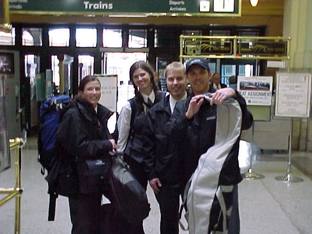
The bellman came to the door at 05:45 h to take our luggage for transport to the train. We later discovered that the luggage is taken overland by truck so that it will be in each Gold Leaf traveller's room by the time they arrive in late afternoon. We went down to the lobby where the Rocky Mountaineer hosts and hostesses were set up to check each passenger's documentation and luggage. While this can be a painfully slow procedure, we found the young ladies and men were very personable and most happy to assist. After check-in, we were directed to a waiting bus. The trip to the station was about fifteen minutes that passed quickly due to our driver, Paul's, running commentary on Vancouver. Vancouver has the second largest concentration of people in North America (second only to Los Angeles, CA). At this time, there are over forty condominiums being built in the city's core with an additional twenty coming on line this year. Many of these twenty plus storied buildings are sold out before the first shovel full of sod is turned. It certainly gave a new meaning to the term concrete jungle. His light but interesting presentation showed he knew how to reach the 50 plus age group so early in the morning.
Doug and I got off the bus immediately on arrival at the station to meet Kate Paquin who is the Communications/Media Manager for the organization. It was Kate who arranged this trip for Doug and myself.
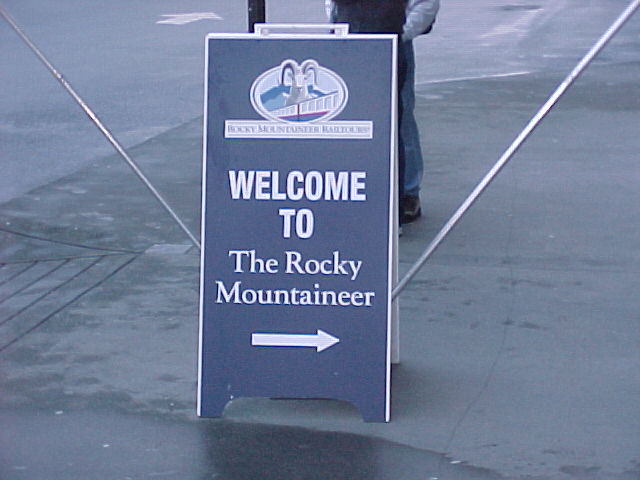
Once at the station, we were guided to the train by what seemed like a cast of a thousand Rocky Mountaineer employees placed strategically throughout the station. Each employee I encountered was warm, friendly and more than willing to help. Many have had previous experience with Rocky Mountaineer.
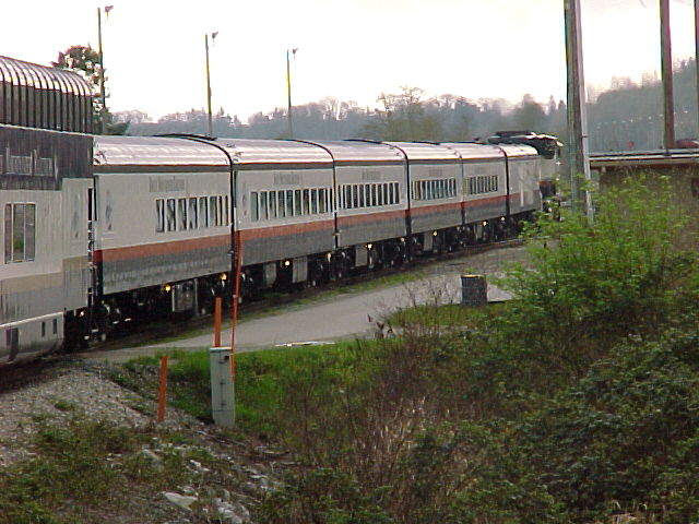
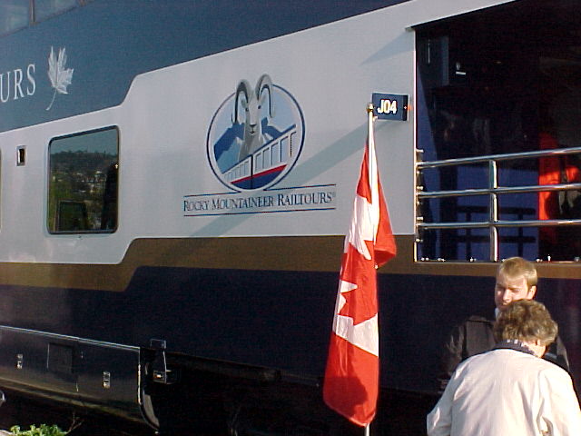
The platform in front of each car was laid with a red carpet and bedecked with Canadian and British Columbia flags. We were heartily greeted and pleasantries exchanged with our attendants. We made our way to our assigned seats in the domed car.
We were quickly introduced to our on-board staff: Kim and Jennifer who would work upstairs and David and Stuart, who would be the servers in the dining car. Most of our car's staff had worked with Rocky Mountaineer for five years but they had never worked together.
As the train started to leave the station, we were treated to a wave-off by the complete staff of Rocky Mountaineer Rail Tours. There must have been fifty-plus employees on the platform waving us goodbye.
The staff immediately started passing out fresh orange juice with the option of it being mixed with champagne. The Guest Service Manager, Barry Crawford proposed the Rocky Mountaineer toast for camaraderie and best wishes for an exciting trip.
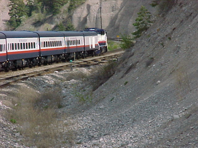
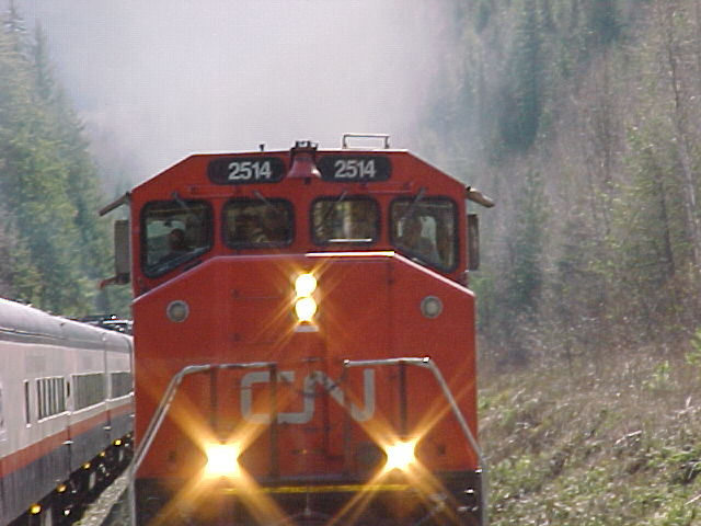
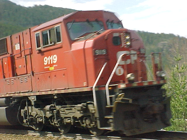
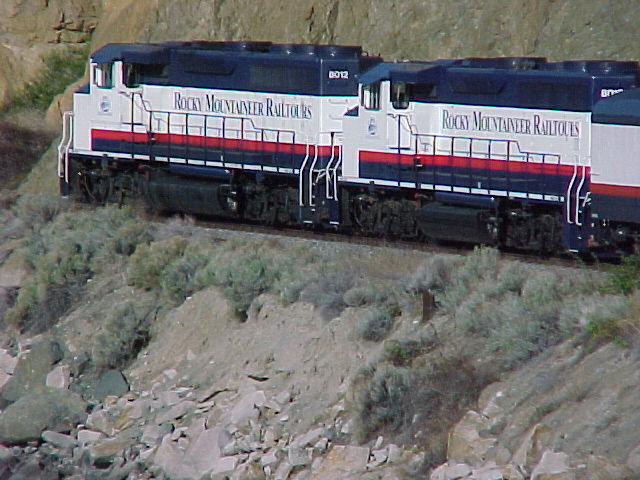
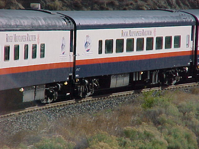
The Rocky Mountaineer operates a fleet of sixty rail coaches plus five locomotives, all of which are used on its routes between Vancouver, British Columbia and Jasper, Banff, and Calgary, Alberta. Canadian National Railway originally used the five locomotives until 2001 when they were refitted and put back into service for the Rocky Mountaineer.
LOCOMOTIVE SPECIFICATIONS
MODEL designations: GP40-2
Locomotive type: (B-B) 0440
Locomotive Horsepower: 3000
Diesel Engine: Models 645E3B
Total Diesel Engine Horsepower: (EMD Standard Conditions)
3195 - 3390, two stroke cycle, 16 cylinder
Speeds: Normal Idle RPM 318; Full Speed 904 rams
Compression Ratio" 14.5:1
Bore and stroke: 23-3/16 cm X 25-1/5 cm (9-1/16" X 10"
Weight on Rails: approximately 120204 kg/265,000 lbs

CAR SPECIFICATIONS

Red Leaf Cars (35)
Built: in the early 1950's for the Canadian National Railway
Made by: Canadian Car and Foundry, Montreal
Coach length: 26 m (86.5 feet)
Weight: 63 tonnes (70,000 lb)

Gold Leaf Cars (10)
Gold Leaf Dome Cars made by: Colorado Railcar in Fort Lupton, Colorado
First dome coach put into service: 1995
These coaches take one year to build.
The Domes are made of shatterproof glass
Each car has a fully equipped stainless steel galley.
Seats: 72 in the dome and about 40 in the dining room at one time.
Each car has an open veranda at the rear of the car for observation and picture taking.
Once our attendants had done the mandatory safety announcements, we were again welcomed and passengers in the front half of the car were told that breakfast awaited them below. The other half of the car's passengers were treated to scones, breads, muffins and more orange/champagne to tide them over until their breakfast.
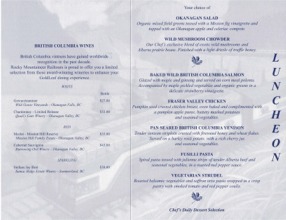
A copy of the extensive breakfast menu from our trip to Jasper may be found below.
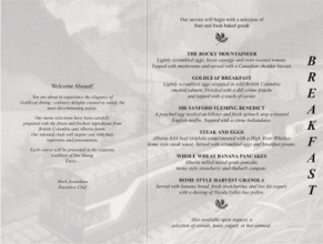
David and Stuart served the breakfasts quickly. After breakfast, we returned to the dome car and the other half of the passengers would soon go down to eat. The meal portions were quite suitable and certainly showed an artistic flair. We soon learned that there would be a lot of eating and a whole lot of sitting.
These cars seem to ride more smoothly than those on VIA's transcontinental Canadian. And the view is spectacular, thanks especially to the fact that the glass dome has been washed.
As we sat in the upper level, one had a 360-degree view of the countryside. The running commentary regularly referred to points of interest on both sides of the train. When this happened people were able to get out of their seats and not miss the views. This might be more difficult without the open aspect of the dome. Jennifer gave us a talk on the First Nations tribes in British Columbia making reference to the Stolo Nation, which translates to "fishers of salmon".
But before we go any further, it is time for lunch.
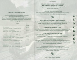
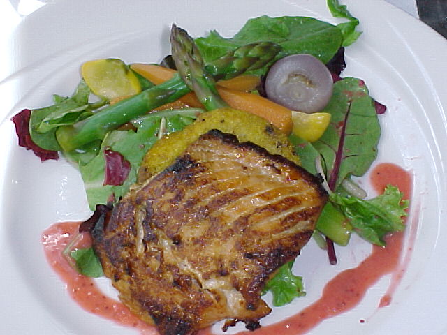
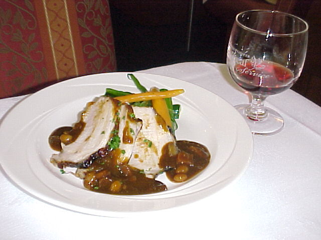
David and Stuart quickly started taking our orders and the splendid food started to flow out of the kitchen.

Award-winning red and white wines from British Columbia's Okanogan Valley compliment each meal.
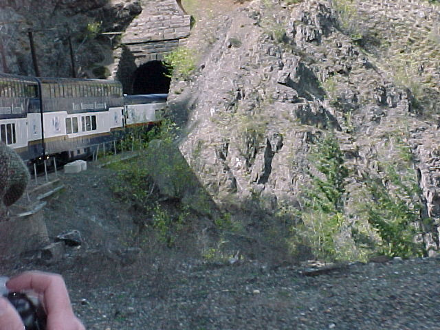
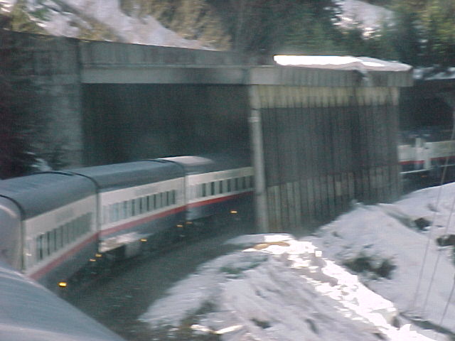
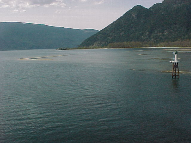
Throughout the morning and into the afternoon we have traversed the Fraser Canyon and into the Fraser Valley. We travelled over the Harrison River Bridge, an 11-span bridge totalling 962 feet. We passed through the first of many tunnels along the Fraser Canyon. We discovered that the local farms of Fraser Valley produce berries, field vegetables, orchard crops, hops, seedlings and Christmas trees.
We travelled through the town of Hope that is situated in the Cascade Mountains at the start of the Fraser Valley. The town is protected on three sides by mountain peaks. The site was named in the "hope" that its location would provide an easier route for the fur traders of the Hudson's Bay Company. Hope was used as the location of the first Rambo movie starring Sylvester Stallone.
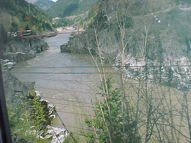
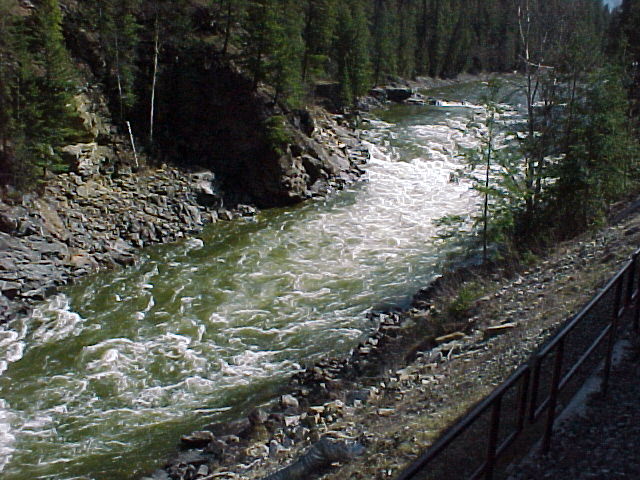
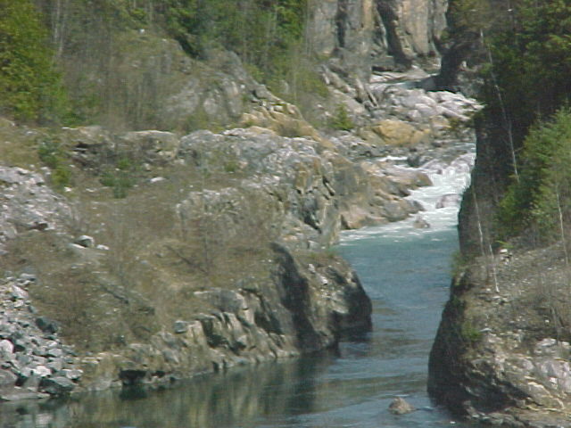
We slowed down as we went around the Fraser Canyon's most popular site, Hell's Gate, which is the narrowest part of Fraser River. As much as 200 million gallons of water move through the 110-foot wide gorge. At this time of the year the Fraser is relatively shallow, as the water has not swollen as a result of the melting of snow in the mountains. When June comes around the difference in depth can be as much as 80 feet.
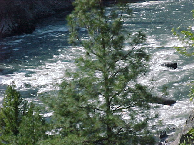
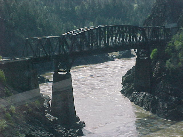
We travelled through places such as Skuzzy Creek, North Bend, and Kanaka (named after the Hawaiians who came to pan for gold in the mid 1800s). At the Cisco Crossings the CPR and the CNR cross the Fraser. This 812 feet long bridge is the largest single span bridge on the CNR with a 425-foot arch. When we got to Lytton, we were able to view the confluence of the Fraser and Thompson Rivers where you can see the mixing of the muddy Fraser and the clear Thompson. After Lytton, we passed through Avalanche Alley where there were noticeable trails of avalanches that had recently come down from the mountains to cover the highway and devastate anything in its way. We passed through the Jaws of Death Gorge, where the Thompson River gorge becomes very steep and narrow, producing some fabulous rapids. This is a favourite summer spot for white water rafters. Another popular summer activity is cycling the Kettle Valley Railroad, an abandoned rail line that has been taken over by the biking community.
We saw the first of many osprey nests. This nest sat on the top of a telephone pole. Lucky for us, the two ospreys were home. This event offered us some close viewing of the Fish Eagle.
We almost forgot, it was once again time for a treat. This time it was huge homemade cookies: Chocolate Chip or Oatmeal and Raisin served with a non-alcoholic Mountain Mist (Cranberry Juice and 7-Up). It was at this time we had a sighting of a golden eagle which was flying the air space adjacent to the train. By the way, to have an official sighting of any wildlife, the object must have been seen by at least three of the travellers.
We passed through Ashcroft, one of the driest places in Canada, with less than 10 inches of annual rainfall. Today, it is a large cattle ranching area. The vegetation along side of the track is now Sagebrush and Rabbit Bush as we move further into a desert region.
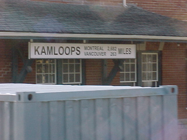
After a very long day, we neared Kamloops around 5:30 pm to be greeted with another slowdown. This time it was the result of a very slow moving freight train heading east. It took almost another two hours to get to the station and then off to the hotels by bus.
Kamloops was a trading centre for the Shuswap people for thousands of years. In 1812 the Pacific Fur Trading Company at the junction of the North and South Thompson Rivers built the first fur trading post. Shortly thereafter a second fort was built on the opposite river bank by a competing fur trading company, the North West Company, which eventually bought out the Pacific Fur company. In 1821, the Hudson's Bay Company arrived and built another fort. Members of the Kamloops Mounted Patrol, a volunteer troupe of mounted cowboys, met the Rocky Mountaineer. We understand they meet each train as it comes into town as well as participate in local celebrations. By the number of pictures being taken it was obvious that they were quite the hit with our weary travellers.
We did have an opportunity to see and learn about the small St. Joseph's Church on the outskirts of Kamloops. It seems that Morgan Freeman, actor, saw this church from the Rocky Mountaineer and fell in love with it. He phoned the producers of a film he was working on and as a result, they made a complete replica of the church for the movie Unforgiven (also starring Clint Eastwood).
Our hosts and hostesses did their best to make light of the situation of the slowness coming into the station at Kamloops, as freight does take priority. A nice treat which saved a great deal of time was the handing out of the room keys on board so there wouldn't be more paperwork when we got to the hotel.
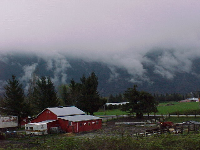
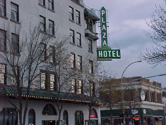
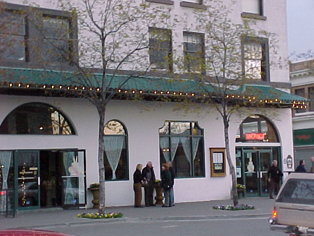
Our travelling companions were assigned to a variety of hotels. Buses took their charges to their hotels quickly and efficiently. I'm sure each bus group was welcomed and enjoyed another narrative as they travelled. Our hotel for the evening was the Plaza Hotel. The hotel has been completely rebuilt and refurbished to its 1930s glory. This was done by a group of community spirited individuals who didn't want to see the old hotel demolished. It was quite beautiful. The hotel staff were very friendly, helpful and outgoing.
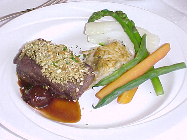
Dinner at the hotel was included in the fare. There was a special Rocky Mountaineer menu. Tonight we decided on the Strip loin steak with garlic roasted potatoes and mixed vegetables. This was preceded by the huge fresh mixed garden salad with a raspberry vinaigrette dressing. The wine was Merlot. And the desert was something to kill for, a non-fattening chocolate mousse cake. Or, at least that's how our waiter described it.
A short walk along the main street followed dinner. Then back to our very comfortable rooms for respite. Today was about three hours too long on the train. It is too bad that the days are so long that you do not have time to do a little discovery of the places we stayed. This was a reoccurring theme throughout our trip.
Day Two - Friday, April 18, 2003 - Kamloops, British Columbia to Jasper, Alberta
The luggage was picked up at 06:30 and we were on the bus at 7:30 for the short ride to the station. Once on-board the bus, our driver started his own tour commentary. Kamloops is the home of the Rocky Mountaineer service department. This is where the trains are kept and serviced. This organization brings a great deal of tourist dollars into this community. It was noticeable by the way our drivers welcomed each and every visitor. Our trip to the station was expanded in an unobtrusive way to point out the history and sites of the town. We got to the station and we waited.
The train this morning has been halved. One group will be going to Jasper through the Yellowhead pass while the other group will be going on to Banff through the Rogers Pass. We waited until the Banff bound group was loaded and on their way before we were boarded. Luckily, it was a beautiful sunny day but somewhat cool. Our ETA for Jasper is about 17:30 h MST (+1h).
Our attendants were ready for our arrival and once again welcomed us on-board. Those people who had purchased souvenirs from the Rocky Mountaineer's extensive catalogue, found their pieces in labelled bags at their seats. Their souvenirs are of very good quality and quite reasonable in cost.
Well, back to business... Food. Today those of us who were on first sitting yesterday reversed to second sitting today.
While we travelled through the Shushwap land reserve, we were served something to keep us from starving. Freshly baked and still warm cinnamon rolls, croissants, and bran or blueberry muffin. As well, our Kim and Jennifer served juice, coffee and tea with what else but a silver tea service.
We started up the valley of the North Thompson River. One of the major crops is ginseng root. The sale of this root and its derivatives has become popular as of late due to naturopathy. Reported benefits of ginseng include stimulation of physical and mental activity, defence of the human system from stress, mental stimulant, and stimulant of the endocrine glands and sexual organs. One could see the crops of ginseng as they were surrounded by wooden frames which had black tarpaulins attached. These tarpaulins are drawn over the plants to filter out the strong light during the hot dry summers. This has become a major export crop for the region.
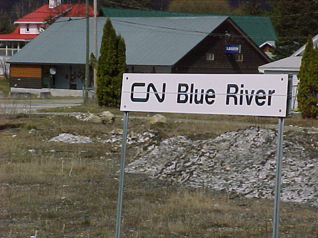
The morning's run of about 134 miles was on CN's tracks of the Clearwater sub-division which follows the North Thompson River to Blue River. To the east we will be going through the Monashee Mountains, which form a barrier between the North Thompson and Columbia River basin. The Monashees start near Valemount and run south for nearly 400 miles ending near the Grand Coulee Dam, in Washington State.
But it is time for breakfast. We seem to moving along much faster today, but then again we haven't gotten close to our destination yet. The menu this morning is the same as yesterday. And it seems to taste even better. Throughout the meal, we also were able to hear the commentary from the girls in the dome above us.
We travelled through McLure, a small station on the east side of the river which housed a cable ferry. The ferry, powered only by the river's current, transported people and vehicles to the west side of the river. We passed Barriere to Little Fort where a similar cable ferry was situated on the west side of the river to take people across the other side. On to Clearwater which is the Gateway to Wells Gray Provincial Park, a 2040 sq. mile park known for its hiking trails, beautiful lakes and waterfalls. Past the village of Vavenby to where the North Thompson River narrows into a canyon, which is referred to Porte d'enfer or Little Hell's Gate. A small group of pioneers known as the Overlanders crossed the Rockies through the Yellowhead Pass, heading towards the gold fields of the Caribou Mountains. When they encountered the Little Hell's Gate, they had to abandon their rafts and go around the rapids by foot. It took them more than three days to make the 8.5-mile journey. We then came to the end of this subdivision at Blue River, which was once the divisional headquarters of the Canadian National Railway. But today it is known for its helicopter skiing in the Monashee Mountains to the east and the Caribou Mountains to the west. Also, one of the west's oldest general stores is located here.
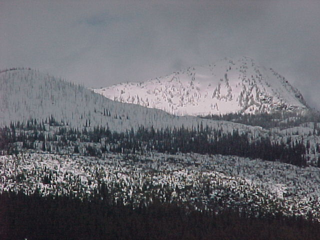
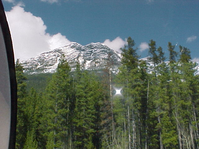
The Blue River to Jasper run is an area full of snow-covered mountains, lakes and wildlife compared to the more rustic area we passed through earlier. Spectacular would be the only word to describe the next part of the trip. Shortly after leaving Blue River, we passed the Pyramid Falls, which cascade 300 feet beside the train tracks. It is noteworthy that the train does slow down considerably to assist those who are making a photo diary of their trip.
As our group went down for luncheon we were nearing the Albreda Glacier. As Jennifer explained, glaciers are formed when snowfall exceeds the amount of snowmelt each year thus resulting in a snowfield. Over the course of years the weight of the accumulating snow compresses the under layers to ice which melts allowing the glacier to run downhill. The glacier's movement results in grinding rocks in to a fine powder and depositing the material in lakes and rivers giving the water its beautiful turquoise colour.
The luncheon menu is all new today. Another exceptional taste experience.
Dessert today was a plate for two to share consisting of cheesecake and a train made of milk chocolate and loaded with chocolate mousse. Another no-calorie dessert.
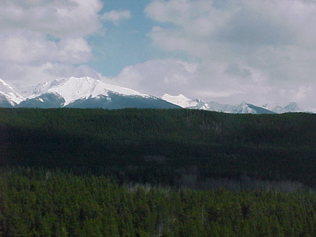
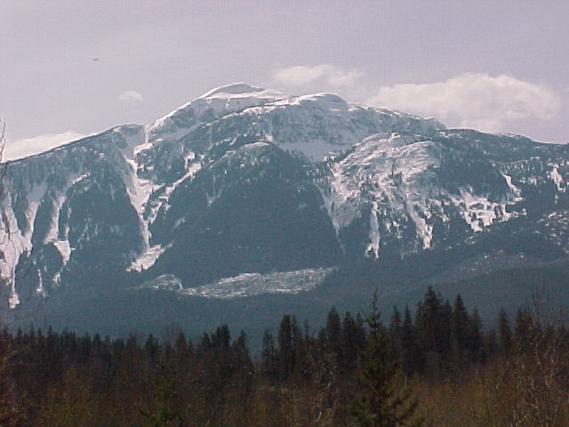
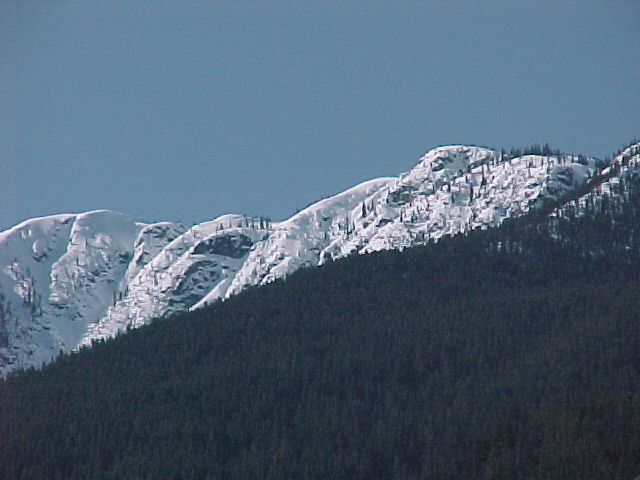
The Premier Range comes into site. The premier range is named after Canada's early Prime Ministers. The mountains are all glacier-topped and range from 8,703 to 11,750 feet in elevation. The mountains include Mount Sir Wilfred Laurier, Mount Mackenzie King and Mount Arthur Meighan. The massive glacier that spreads across these three peaks is the headwaters of the North Thompson River as well as a major source for the Fraser and Columbia River systems. Soon we passed the highest mountain in the Canadian Rockies, Mount Robson at 12972 feet. Aboriginal people named it Yuh-hai-has-kun meaning the "Mountain of the Spiral Road". Colin Robertson of the Hudson Bay Company had a very successful fur trade with the local fur trappers. Because of the successful relationship it was thought that the Aboriginals named the mountain after Robertson. Over a period of time it was shortened to Robson. This mountain is part of Mount Robson National Park that is adjacent to Jasper National. Both areas are part of the Canadian Rocky Mountain Parks World Heritage Site. These parks allow the natural ecosystem to remain balanced with little interference from man.
Today, Doug was in photographer's heaven. Not only were we presented to magnificent snow-capped mountains and glacier-fed waterfalls and lakes but we were also in the last car, so he could be on the outside deck and get some absolutely fabulous pictures. Mid afternoon, we were once again introduced to the chefs who passed around chocolate maple leafs. Just what we needed.
Near the end of our day we passed through the Yellowhead Pass. At 3718 feet above sea level it is one of the lowest points of the Continental Divide, having made this point a favourite for aboriginals and settlers to cross through the Rockies. We crossed the Continental Divide, which separates the Atlantic and Pacific watersheds. It also marks the boundary between Alberta and British Columbia.
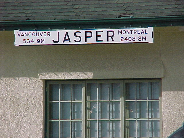
We entered Jasper National Park, which has been a protected site since 1907 and is the largest of the Canadian Rockies National Parks. By about 17:30 h, we had arrived into the Town of Jasper (est. 1801). We were efficiently whisked away by buses for the 15-minute trip to Fairmont's Jasper Park Lodge. It is interesting to note about two million people visit Jasper each year; a significant difference from a population of only 4,300 people. Since Jasper is in the National Park boundary, it cannot grow exponentially as it is governed under the principal of no net negative environmental impact.
This marked the end of our two-day trip. Farewells were expressed to our on-board attendants. For a group of young ladies and gentlemen who had never worked together prior to this trip, they did a marvellous job. Kim, Jennifer, David and Stuart were exemplary representatives of Rocky Mountaineer guest services. Throughout the week it was amazing to see how they danced like a practised team. While all had very separate and distinct personalities, it was obvious that they were enjoying themselves while they provided the highest quality of service to the passengers. We salute them. At this point the team was leaving to spend the weekend on the ski slopes of Jasper.
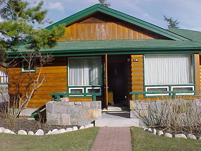
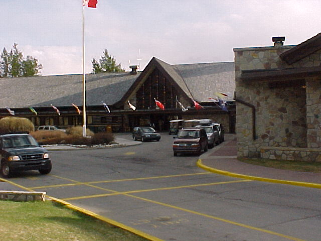
Fairmont's Jasper Park Lodge is our home this evening. The Fairmont Jasper Park Lodge has a spot in tourism history of the Canadian Rockies. Its legacy began in 1915, in association with the Grand Truck Pacific Railway. Originally called "Tent City", it consisted of a few tents on the shores of beautiful Lac Beauvert. In 1922, eight log bungalows were built for guests. Expansion proceeded through 1923, with the addition of the first unit of the main building and additional guest cabins. Some of these original cabins still stand today. The 1920s saw the addition of Jasper's world-famous golf course, designed by master architect Stanley Thompson. Tourists continued to flock in and by 1940; enough luxurious cabins had been built to house 650 guests. Bing Crosby became a regular visitor. In July 1952, the original main building, at that time the largest single-story log structure in the world, was destroyed by fire. By June of the following year, Jasper Park Lodge's new main building featured stunning views of its surroundings. Between the early 1940s and early 1950s, most of the original log cabins were replaced with modern attractive cedar chalets. Today, the Lodge consists of the main building and 56 adjacent chalets for a total room count of 446. As well, the hotel sports a number of boutiques, a sports lounge, and multiple dining facilities. Our cabins were very clean, well equipped and very comfortable. Staff members went out of their way to serve and help us.
Tonight, after two days of plentiful and rich meals, we decided we would have a light meal, a walk and an early evening. Dinner was in the Emerald Lounge, which seems to be the centre of activity within the hotel proper.
Day Three - Saturday, April 19, 2003
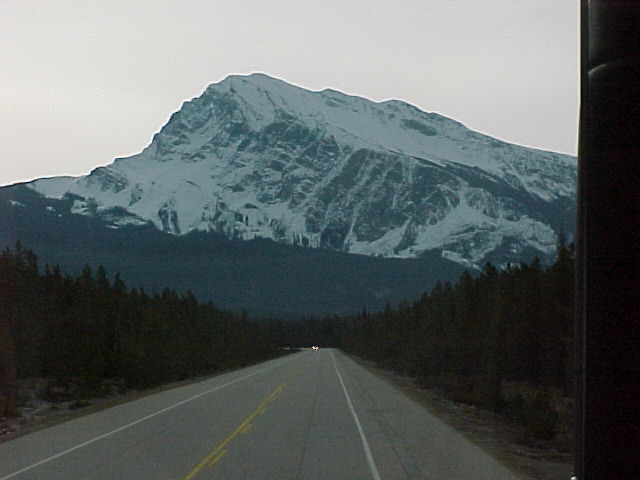
An early morning breakfast buffet was accompanied by very quick and polite service. It was a delightful hot and cold feast that would hold us for the best part of the day. Well, at least we expected it would. We boarded a bus for a full day tour of Ice Fields Parkway. The scenic 199-mile highway that stretches between Jasper and Banff, Alberta provides an unparalleled view of the chain of massive ice fields that straddle the Continental Divide.
Our driver was Christian, a transplanted Montrealer who had worked on the Columbia Ice Fields as well as in the local area for eight years. He explained early on that he was hearing-impaired so that if he ignored you it was just that he didn't hear you. What a marvellous and knowledgeable guide. This man started his commentary shortly after leaving the hotel and often threatened to let us sit in silence and enjoy the scenery. Fortunately, he had so much to tell and he was so enthusiastic in his description that he would just continue on.
As soon as we started down the Parkway, we pulled off to see the Athabaska Falls. This fall carries the most water of any Rocky Mountain river and the 70-foot fall presents a noisy spectacle. The volume of water going over the falls will increase greatly as spring continues into June and July. At this, our first stop, Christian was ready to supply each of us with a bottle of water. He said that in the next sixty miles we would climb over three thousand feet. An increase in elevation brings on dehydration so he encouraged us to drink lots of water.
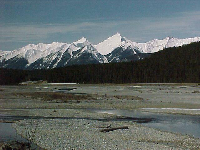
The parkway now enters the Athabaska Valley, a valley that stretches over 700 miles and eventually its river of the same name empties into Lake Athabaska in northern Alberta.
Even at this time of the year, the road is regularly surveyed for weather conditions. As we go up to 6600 feet above sea level, weather can change very quickly. The road is regularly closed due to heavy snows, accidents and avalanches.
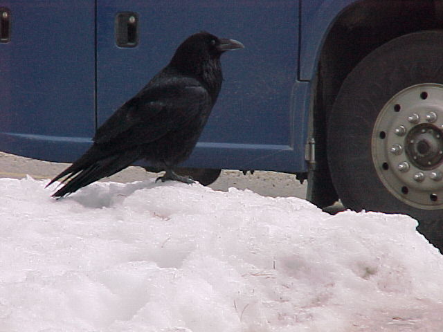
Today was going to be a very relaxed trip with frequent stops. We stopped next at the Sunwapta Falls where the Sunwapta River crashes through a gorge made of quartzite, one of the hardest stones found in the Rockies. A large raven hoping for some early season food handouts entertained us. It was obvious, that this bird was quite tame and not wary at all of the human species.
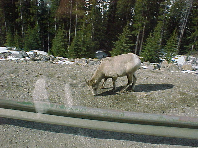
All along the Parkway, the motorist and photographer must remain vigilant for wild animals standing along the road. Roads are a major source of wildlife deaths. Over 130 animals are killed on Jasper National Park's roads every year. A wild animal can run out at a moment's notice, especially at the dusk and dawn times when they tend to be close to the road. It is a major impetus to keep the animals wild by the Parks Authority. They discourage the feeding, approaching or even touching of these animals even though they might appear to be tame.
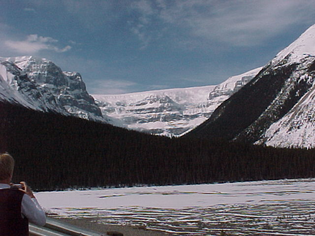
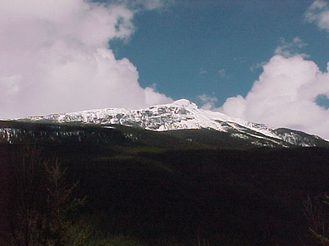
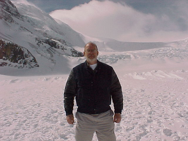
We arrived just before lunch at one of the highlights of today's trip: The Athabaska Glacier and the Columbia Ice Field. This ice field once formed a sheet of ice that stretched north of Jasper and joined other glaciers that moved east to the prairies and south past Calgary.
THE ICE COLD FACTS
The Columbia Icefield
Area 130 sq. miles
Average Elevation 10,000 feet
Average Depth 1,200 feet
Average Snowfall 23 feet/year
Drainage: Pacific, Arctic and Atlantic Oceans

Athabaska Glacier
Area 2.5 sq.miles
Length 3.75 miles
Depth 270-1000 feet
Surface Speed
Ice field: 400 feet/year
Toe: 50 feet/year
Icefall: 8900 feet
Snocoach Turn around: 7000 feet
Toe: 6300 feet
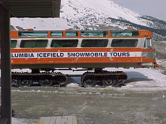
We disembarked the coach and were quickly transferred to another bus that took us out to the ice field. On board our driver quickly introduced himself and started on his part of the commentary. He described how the glacier was initially formed and the parts of the glacier we could see. After a short ride, we climbed on one of the Snocoaches with another transplanted driver, this one from Newfoundland. These buses are much larger than the old land rovers with tracks that they used to have taking people out on the field. These bulky Snocoaches have wheels that are about 6 feet high and almost 4 feet wide and each one carries 56 passengers. The design has much less environmental impact than former methods of transport. Our driver continued with the educational commentary. He pointed out the terminal and lateral moraines present. The rock under the Ice Field is mainly limestone, shale and dolomite. He made special note of how much the ice field had melted in the past 150 years. Looking back at the Ice Field Centre, the flagpoles indicate where the glacier sat in 1840, over a mile away.
The glacier used to fill up to the top of two lateral moraines shown in the pictures. During our stay, we were lucky to see a couple of mini-avalanches occurring from the mountains around us. We also noticed three hikers who were heading toward the icefalls.
We were then taken back to the Centre for lunch a la cafeteria-style.
After lunch, we continued to head south through the Sunwapta Pass (el. 6,637 feet) which marks the boundary been Jasper and Banff National Parks. An interesting note was that early pioneers to the area found the Sunwapta Valley blocked by the Athabaska Glacier. The only way they could continue would have been to climb up and around it. When the highway was being built, the glacier had receded enough and a detour was no longer needed.
We traveled past Parker Ridge and soon came to the Cirrus Mountain viewpoint, which provided a splendid view of the North Saskatchewan Valley. We soon saw the Weeping Wall on the eastern flank of Cirrus. The 2,000-foot cliffs are fed by melting snow and in the winter it is an ice climber's heaven. The Bridal Veil Falls was the next highlight before coming to the Big Bend that is the largest hairpin turn in Canada. It prepares for a rise in elevation of 1450 feet.
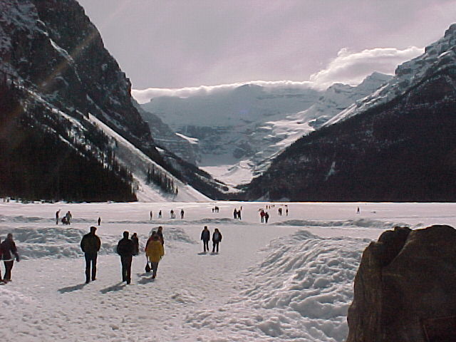
We soon passed Mount Chephran (el. 10,850 feet) and Howse Peak (el.10794 ). Finally, we came to Lake Louise. We had a break to take a look at the lake. Unfortunately, the ice still had a grip of the lake. Fairmont's Lake Louise Hotel was a magnificent structure and is presently going through a major renovation.
We left for our hotel in Banff. Tonight we will be staying at the castle, The Banff Springs Lodge. After check in, we walked into Banff to do a walking tour and have dinner.
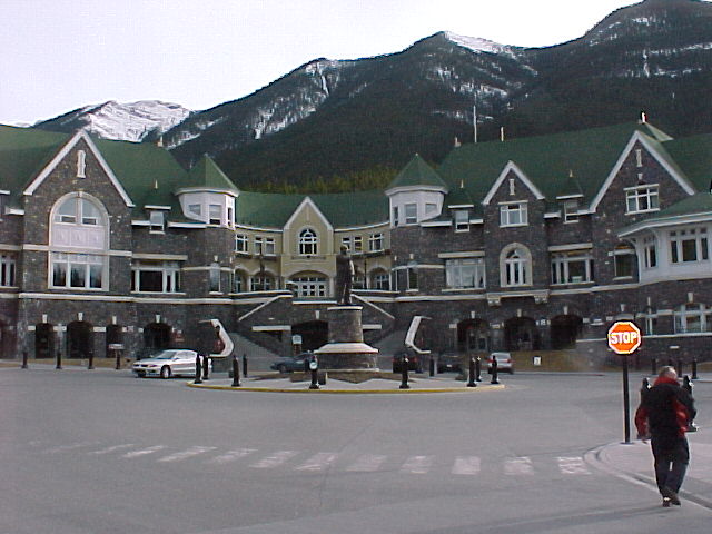
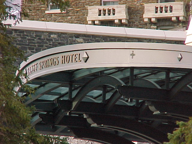
The Banff Springs is Fairmont's western Canadian flagship resort and conference centre. It was designed and built in 1888 with a style reminiscent of a stately 19th century Scottish Baronial castle. It has just undergone a multi-million dollar renovation and addition.
Day Four - Sunday, April 20, 2003
After a restful sleep, we were to meet the bus for loading and departure no later than 07:00 h. Unfortunately, whom ever was setting the schedule didn't let the rest of us know that it would be almost 7:50 h by the time the bus arrived. It was about 0 degrees Celsius and was quite cold for those who weren't prepared to stand and wait. When the bus arrived, an air of total disorganization quickly took over. Being that we had quite a few older people with us, the staff of Rocky Mountaineer should have quickly arranged a spot either in the hotel or right on the bus to do the checking in. People's travel documentation had to be checked and their luggage tagged and loaded before they were allowed on the bus. We were among the last ones on the bus, and it was close to 8:30 h before we departed.
Once on the bus, we quickly made our way to the station and were boarded relatively quickly. A new team of attendants met us. One attendant read quickly through the safety procedures while the other rushed around doing something. The train's general service manager was James Tobin, while our car attendants were Tim and Rumi upstairs. Thadee and Chrystal served in the downstairs dining room. This time there were 262 guests on board with fifteen cars in the consist.
First call for breakfast was made and those people in the first group went down. Meanwhile upstairs, we were served champagne and orange juice along with muffins and Danish to tide us over.
We retraced a part of yesterday's trip down the Glacier Parkway. We headed for Lake Louise before going west. We passed by Castle Mountain, a rugged multi-turreted castellated mountain. It was named by Dr. James Hector in 1858 after its obvious castle like structure. In 1945, Prime Minister Mackenzie King renamed it in honour of the Supreme Allied Commander during WWII, Dwight D. Eisenhower. The locals were not at all enthralled with the name after it was discovered that Eisenhower wasn't going to attend the dedication due to a golf game. The original name was reinstated in 1979 by the Trudeau government. However, the first tower on the mountain remains the Eisenhower Peak. As well, there is a small plateau that is referred to Eisenhower's green.
Our trip today will be in part through Yoho National Park and Glacier National Park, which sports 52 different glaciers. Tim, one of our service attendants, pointed at the steel forms that were along the highway. They turned out to be howitzer mounts. The howitzers are used to control avalanches. They shoot the cannon at the snow formation to encourage smaller avalanches before a more serious one can occur.
We soon headed by Lake Louise and passed the Mount Victoria Glacier with an elevation of 11,365 feet. We pass through the Continental Divide at Stephen and the boundary between Banff National Park in Alberta and Yoho National Park in British Columbia. It was the highest point on our journey, at 5,332 feet above the sea level. An interesting point of trivia is the town was named after George Stephen, the first president of the CPR. Mt Stephen is also named after him. When he was knighted he took the title of Lord Mount Stephen in effect naming himself after the mountain that was named after him.
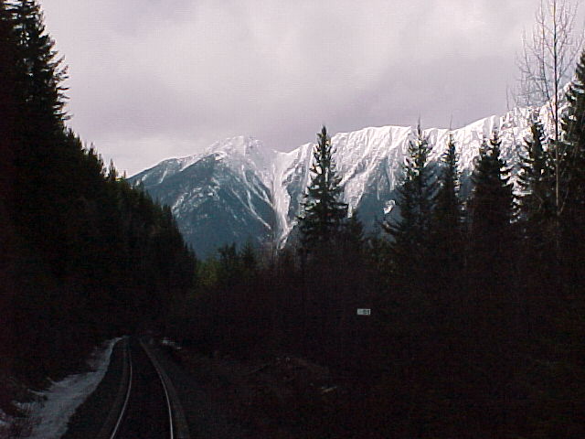
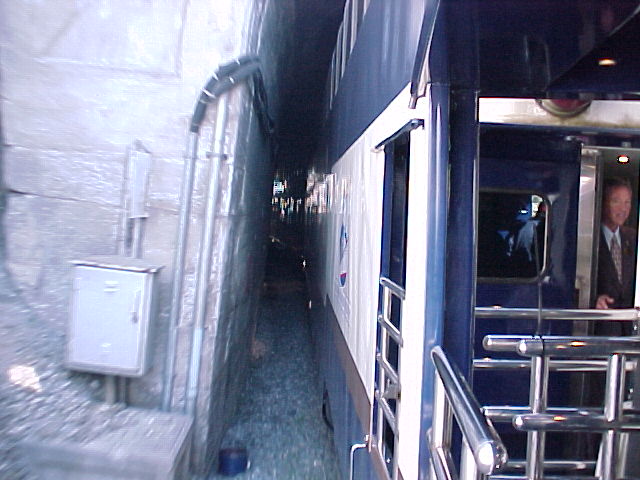
We traveled on to one of the most interesting feats of early-nineteenth century railway construction, the Spiral Tunnels. This was a track of steel that was about eight miles in length between Field and Hector, BC. The Big Hill was extremely dangerous at a 4.5% grade. As well, it caused enormous costs in repairs, wages and operational expenses. In 1907, construction began on the Spiral Tunnels. It took one thousand men twenty months to complete. It involved the evacuation of 750,000 cubic yards of rock and cost over one million dollars. It reduced the grade to a more manageable 2.2%. The 3,255 foot-long Upper Spiral travels through Cathedral Mountain and turns 283 degrees, emerging 50 feet lower. The Lower Spiral is tunnelled through Mount Ogden. At 3,200 feet long, it turns 220 degrees, dropping 56 feet from the entrance. As the railway timetable of the day put it, "The whole thing is a perfect maze, the railway doubling back on itself twice, tunnelling under mountains and crossing the river twice in order to cut down the grade."
Second sitting for breakfast was soon called. We were greeted and seated by James and we were quickly filling our stomachs with the Rocky Mountaineer's breakfast delights. The menu used was the same as our trip eastward. This morning's ride was a breath-taking experience with vistas of snow-capped mountains.
Near the town of Field, our attendants told us about a very significant fossil find, the Burgess Shale. Discovered in 1909 by Charles D. Walcott, then the Secretary of the Smithsonian Institution, the Burgess Shale not only challenged the evolutionary theories of Charles Darwin but also provided a glimpse of what life was like on Earth some 505 million years ago. Imagine a five-eyed Opabinia with an elephant-like trunk with a fierce claw at its end or a simple looking Pikaia, looking like a worm, but in fact a primitive chordate, and our oldest known ancestor. The fossils are special due to their great age and their fine preservation. It is a protected site within the Rocky Mountain Parks Heritage Site.
We travelled through the Kicking Horse Canyon and crossed the river of the same name seven times. The river is a braided river system and has a tide system as well. This was the pass discovered by James Hector, a geologist in the famous Palliser expedition. The expedition explored and mapped various portions of Western Canada. Kicking Horse Pass was named after an unfortunate incident. Hector was kicked in the chest and knocked unconscious for hours by one of his packhorses. He recovered and did return to this area, however, it was in a luxurious rail car.
We passed through Golden, where the Columbia River provided early travellers with access to a waterway that leads to the Pacific Ocean. On to Beaverbrook, Rogers, and Mountain Creek, where we cross a bridge of some 600 feet long over the river which is 136 feet below.
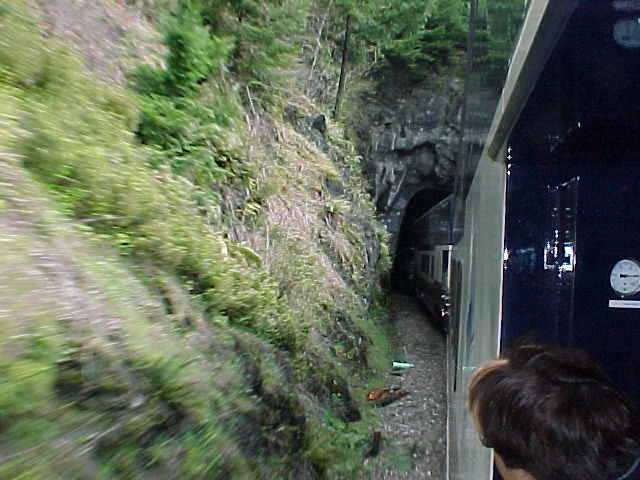
The train slowed to a crawl for picture taking. The Stoney Creek Bridge is located on the eastern slopes of Mount Tupper. A wooden structure had been placed there originally but was replaced in the early 1890s. The new bridge constructed of steel, was arch-shaped. By the late 1920s, with locomotive weight doubling that of earlier ones, the CPR had to replace the bridge. Unfortunately, after the usual studies they determined that they could not build it in any other location save the present site. They set about to build the new bridge over the old one without putting any pressure on the old bridge. The next point of interest was the Connaught Tunnel, a 5-mile-long tunnel built to avoid the terrain and heavy snowfalls in the Rogers Pass. The tunnel bore through Mount Macdonald. Recently, it has been improved and allows twenty-four trains to pass through per day rather than the previous maximum of fifteen trains.
Shortly down the track, we came to Glacier House. This was a meal stop for the early transcontinental trains, as they didn't carry dining cars due to the steep grade. It remained a popular spot until 1925, when it was closed due to passenger trains being re-routed.
Lunch was served. The meal was ordered from a menu similar to that on the first trip. Unfortunately, the quality control had changed somewhat and this was confirmed in discussions with other full-tour guests.
We passed along the Illecillewaet River, an aboriginal word meaning "swift waters". Soon we passed through Revelstoke (pop.8,300). The numerous tunnels and snow sheds along this set of tracks are used to protect the trains from heavy snowfall and frequent avalanches. We got a quick view of Kay Falls, a cascading waterfall down Mount Griffin. We followed the Eagle River for about 30 miles. During the later part of September, travellers can often see the spawning salmon.
At Craigellachie, we slowed down for pictures of where the last spike of the CPR was driven on November 7, 1885 by Donald Smith. This is the spot where Canada was first linked by rail from sea to sea. The railroad was completed in 54 months, almost six years ahead of the original schedule.
We crossed over the Shuswap River and on to Sicamous, which lies between the Shuswap and Mara Lakes. These lakes have over 510 miles of shoreline and are home to over three hundred houseboats for exploration during the summer months. Shuswap Lake is a geo-thermally heated lake. It never freezes over and its annual average temperature is 75 degrees Fahrenheit.
Another forty-five miles later, we arrived at Adams River, the site of the world's largest salmon run. Rumi and Tim enlightened the passengers on this feat of nature. In early September, 4-year-old sockeye salmon start their inland journey of over 350 miles at a rate of about 18 miles per day in order to mate and start the life cycle all over. It is a most fascinating story.
Today being Easter Sunday, the Easter bunny showed up in the person of James Tobin, and wetted our tongues with milk chocolate.
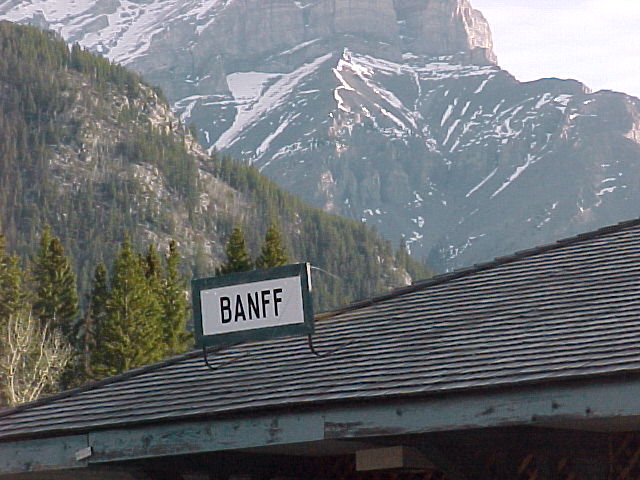
As we neared our stop for the day, Kamloops, we passed by hoodoos. Hoodoos are irregularly shaped rock formations that often resemble misshapen pillars, spires, columns, or grotesque, animal-like figures. Their dimensions range from centimetres to metres. Hoodoos are usually attributed to erosion and weathering of the rock face. Although hoodoos can develop in all kinds of rock, they are probably more common in sandstone, limestone, siltstone, and salt deposits. As for the example near the small village of Pritchard, the hoodoos are all that is left of a great lakebed of 10000 years ago.
The Great Train Robbery happened at mile 111.3 a place called Duck Station, The infamous robber; Billy Miner and his gang robbed the wrong train. The train they had hoped to rob had been delayed. They instead ended up with $15 and a handful of liver pills. On top of this, their horses wandered away one evening after they had made their getaway. The Royal Canadian Mounted Police soon captured them. He was sentenced to life imprisonment. Billy soon escaped from the jail. He died seven years later in a Georgia jail having served two of a twenty-five year sentence.
The weather today was absolutely spectacular. The sunny, clear skies made observation and picture-taking a delight. Unfortunately, as we neared Kamloops, our spell of good weather was about to change. It was cool, dreary and raining as we arrived into Kamloops.
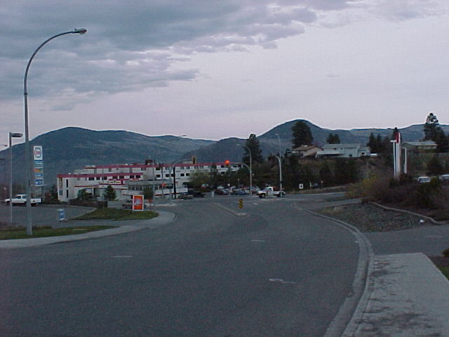
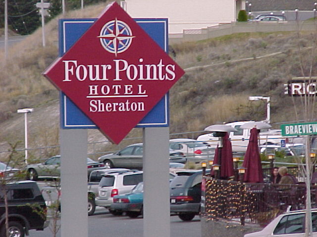
The hotel room keys were once again organized for distribution on-board. When we disembarked, we were loaded on to buses and driven to our hotels arriving at about 19:00 h. We were staying this evening in the Sheraton Hotel, which is located almost on top of the hill overlooking Kamloops and the valley below. The hotel dining room was quite busy but we made reservations for a late dinner.
Day Five - Monday, April 21, 2003
The bus pick-up was on time this morning at 07:00 h. This would be a very long day, as we would end the day on a flight from Vancouver to Toronto commencing at 23:05 h. We had another tour of downtown Kamloops as we headed toward the train station. We were loaded quite quickly this morning and were soon on our way. Today's weather is cloudy and cool with rain in the forecast for Vancouver.
The trip back to Kamloops mimicked the trip of four days earlier on our way inland. We noticed a couple of things different. The dialogue today seemed to be somewhat sparse, possibly because we were backtracking to Vancouver and we had "been there, done that." At times, it seemed that our attendants were busy doing a variety of tasks and by early afternoon the trip was all but finished in their minds, possibly to let us rest peacefully and reminisce of our past few days of travel. We were also surprised at lunch. As the menu was a repetition, we ordered the same meal for comparisons sake. We were surprised by what seemed to be quite smaller portions. But then again, after stuffing us every day, possibly they were a little short on food, or preparing us to go back to "our own world."
We reached the Vancouver train station right on time. It was time to bid our fond farewells to travellers and staff alike. We had a wonderful experience, five days of sunny, warm spring-like temperatures and absolutely breath-taking scenery.
Click to view each set of detailed photos below:
Thursday, April 17, 2003
Set #01 /
Set #02 /
Set #03 /
Set #04 /
Set #05 /
Set #06
Friday, April 18, 2003
Set #07 /
Set #08 /
Set #09 /
Set #10 /
Set #11 /
Set #12 /
Set #13
Saturday, April 19, 2003
Set #14 /
Set #15 /
Set #16 /
Set #17 /
Set #18 /
Set #19
Sunday, April 20, 2003
Set #20 /
Set #21 /
Set #22 /
Set #23 /
Set #24 /
Set #25
Monday, April 21, 2003
Set #26 /
Set #27 /
Set #28 /
Set #29 /
Set #30 /
Set #31 /
Set #32
Click here
for the continuation of this trip
aboard VIA Rail Canada!